I want to...
Current filter: Most popular
A to Z
Apply for a job
Biosecurity
Consents
Consultation
Contact Us
Environmental Data
Farmers Hub
Fix it or Report it
Information Request
Join an Event
Leasehold Land
Meetings
Rates
Water Metering
Have Your Say
Hawke's Bay cycle trails voted in Top 10
Published: 12 January 2017

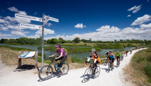
There’s no better time than the middle of a hot Hawke’s Bay summer to grab your bike, or hire one, and enjoy the beautiful Hawke’s Bay cycle trails.
Whether it’s the popular Puketapu loop – just voted one of Lonely Planet’s 10 Stunning NZ Bike Rides, a cruise out to Te Awanga, Bay View, or taking in a selection of cellar doors, Hawke’s Bay Trails and the iWay network have something for everyone.
Not a trail fan? We’ve also got a top-class road-riding plus mountain-bike trails at Pan Pac Eskdale MTB Park, Te Mata Peak and Waipukurau.
The trails don’t look after themselves. They are the product of a local councils working closely together. Vicki Butterworth is funded by all councils in Hawke’s Bay. Her role as Cycle Network Coordinator is all about keeping a world-class trail in good shape and developing new sections of network over time.
“I want our cycling experience from Wairoa to Waipukurau to be one of the best in the country,” says Ms Butterworth.
“Our best way to improve the cycle network we have comes from feedback. People constantly tell me how much they love being out and about on our trails in Hawke’s Bay, and give me suggestions for improvements,” adds Ms Butterworth.
For summer trail blazers, here’s some local knowledge to help you get the best two-wheel experience:
- Puketapu has a brilliant river swimming spot and park, ice-creams, cold drinks and local hospitality. It’s a destination as well as the half-way point on the Puketapu Loop from Taradale.
- Marine Parade has a couple of trail detours between the Sunken Gardens and Bay Skate. Napier City is finishing off redevelopments in this area until March, so take it easy and give way to pedestrians in the narrow sections.
- There are new dedicated walk/ cycle bridges at Awatoto, across Tutaekuri River, and at Pakowhai, across Ngaruroro River. The ‘Chesterhope’ clip-on links Gilbertson Road/ Brookfields Bridge to Pakowhai Park, now ideal for cycle commuters between Napier and Hastings.
- The latest trail map now shows underpass and road crossing points for some of the busier main roads. Underpasses often come with changes to gradient and blind corners. These trail areas at Ahuriri estuary come with tidal flooding, so take extra care if you ride or walk your bike through water.
Share your favourite ride on the hbparkstrails facebook page. If you see an issue on the trail, related to the surface, signs or rubbish dumping, drop a note to the Regional Council, vicki.butterworth@hbrc.govt.nz.
Coming up from late January, the East Clive coastal trail will have detours in place while a new outfall pipe is installed, and a new pipeline will be installed at State Highway 50 from Te Awa Estate Winery to Unison Vineyard.
Disclaimers and Copyright
While every endeavour has been taken by the Hawke's Bay Regional Council to ensure that the information on this website is
accurate and up to date, Hawke's Bay Regional Council shall not be liable for any loss suffered through the use, directly or indirectly, of information on this website. Information contained has been assembled in good faith.
Some of the information available in this site is from the New Zealand Public domain and supplied by relevant
government agencies. Hawke's Bay Regional Council cannot accept any liability for its accuracy or content.
Portions of the information and material on this site, including data, pages, documents, online
graphics and images are protected by copyright, unless specifically notified to the contrary. Externally sourced
information or material is copyright to the respective provider.
© Hawke's Bay Regional Council - www.hbrc.govt.nz / +64 6 835 9200 / info@hbrc.govt.nz


