I want to...
Current filter: Most popular
A to Z
Apply for a job
Biosecurity
Consents
Consultation
Contact Us
Environmental Data
Farmers Hub
Fix it or Report it
Information Request
Join an Event
Leasehold Land
Meetings
Rates
Water Metering
Have Your Say
HB hazard portal now reports on contaminated sites
Published: 20 April 2022

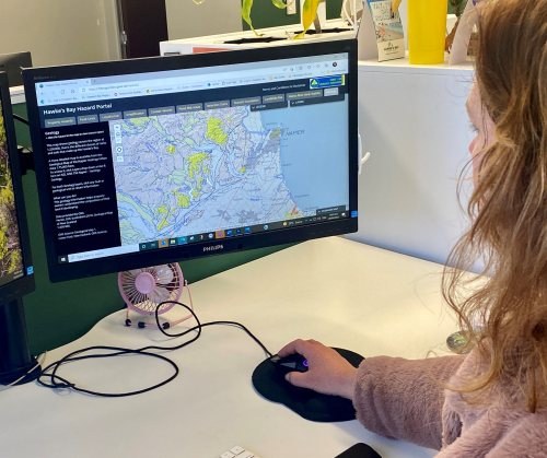
Hawke’s Bay Regional Council has added a Hazardous Activities and Industries map layer to the Hawke’s Bay Hazard Portal, as part of its programme to unlock data for public use.
The Hazardous Activities and Industries List (HAIL) records sites used in the past, or currently in use, for activities with the potential to cause contamination from hazardous substance use, storage or disposal.
HAIL sites will also appear in the portal’s free hazard property reports, available by request at the property locator in the portal. The reports now auto-generate to deal with a daily volume of 70 requests. People can check an address’ hazard information including liquefaction, fault lines, tsunami or flood risks for their current property, or a property being considered for purchase or development.
“We’ve seen growing demand for hazard reports from businesses such as surveyors, valuers, lawyers, and the public, so we’re pleased to now offer a better digital service and add the Hazardous Activities and Industries layer to this offering,” says Regional Council compliance manager Rob Hogan.
The past use and storage of hazardous substances has left a legacy of soil contamination in urban and rural areas of New Zealand. Contaminated sites are often associated with industrial activities, but commercial, agricultural, and residential land uses can also result in contamination.
“Land identified as a HAIL site does not mean it is contaminated, only that it has been used for an activity that could have resulted in contamination,” adds Mr Hogan.
The Ministry for the Environment produced a Hazardous Activities and Industries List (HAIL) that identifies activities that do, or are likely to, cause pollution to the environment if not appropriately managed. A piece of land is considered a ‘HAIL’ site if one of the activities in the HAIL list is occurring, or has occurred in the past, on it. Hail sites are categorised differently depending on what we know about the site. Further detail about classifications can be found here.
The Hazard Portal, first launched in 2015, holds all current hazard information for individual Hawke’s Bay properties, with an easy-to-read layout and navigation tabs.
Hazard reports do not replace Land Information Memorandums (LIMs), which are the most comprehensive report available for a property.
MORE INFORMATION
How the Ministry for the Environment manages contaminated land
environment.govt.nz/facts-and-science/land/contaminated-land/
To raise a query, or find out how Hawke’s Bay Regional Council manages contaminated land
hbrc.govt.nz/services/pollution-and-waste/contaminated-land/
Hawke’s Bay Hazard Portal
hbhazards.co.nz/
Disclaimers and Copyright
While every endeavour has been taken by the Hawke's Bay Regional Council to ensure that the information on this website is
accurate and up to date, Hawke's Bay Regional Council shall not be liable for any loss suffered through the use, directly or indirectly, of information on this website. Information contained has been assembled in good faith.
Some of the information available in this site is from the New Zealand Public domain and supplied by relevant
government agencies. Hawke's Bay Regional Council cannot accept any liability for its accuracy or content.
Portions of the information and material on this site, including data, pages, documents, online
graphics and images are protected by copyright, unless specifically notified to the contrary. Externally sourced
information or material is copyright to the respective provider.
© Hawke's Bay Regional Council - www.hbrc.govt.nz / +64 6 835 9200 / info@hbrc.govt.nz


