Current filter:
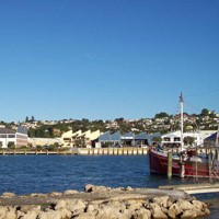
Hawke’s Bay Regional Council environmental scientists gave the latest climate briefing on Friday 19 January.
Climate – HBRC Climate Scientist Dr Kathleen Kozyniak
There was ample rain in the north in December, but it was drier than usual elsewhere. January has started well with all ranges, northern parts of the region and CHB already hitting the January average.
Soil moisture is near or above average in most areas, though possibly drier than usual around the south coast.
Hawke’s Bay has a weak La Niña for summer, which is expected to transition to neutral conditions in autumn. Climate models favour an east to northeast flow over the country for the remainder of summer due to a pattern of highs to the southeast and lower than usual pressures to the north and in the Tasman Sea. That raises the chance of higher than normal rainfall for Hawke’s Bay or at least decreases the risk of below normal rainfall.
Groundwater – HBRC Groundwater Scientist Simon Harper
Groundwater levels in early November were measuring near normal levels. By early December, groundwater levels had sharply declined in both the Heretaunga and Ruataniwha Plains. For December, groundwater levels on the Heretaunga Plains measured a mix of normal and below normal conditions. Typically, below normal groundwater levels cluster in the unconfined area west of Fernhill but for December these conditions were also observed in wells located over the confined area. On the Ruataniwha Plains groundwater levels measured a mix of normal, below normal and lowest-ever December groundwater levels. These conditions were spread across the Ruataniwha Plains.
Our telemetered sites show groundwater levels rose between mid-December and mid-January. Our January groundwater levels are scheduled to be measured in late January. We anticipate an increase in normal conditions for this month in response to the rainfall received between mid-December and mid-January.
River Flows – HBRC Hydrologist Rob Waldron
River flows across all sites in the region during December 2017 were either below or close to normal. Meanwhile this month, provisional figures show river flows across most sites in the region are above or close normal, with the exception of river flows in the Southern Coastal and Porangahau areas, which below normal.
To watch the full climate briefing click here
23 January 2018
+64 6 835 9200
159 Dalton Street. Napier 4110
Private Bag 6006, Napier 4142
Disclaimers, Copyright & Privacy
![]()
Disclaimers and Copyright
While every endeavour has been taken by the Hawke's Bay Regional Council to ensure that the information on this website is
accurate and up to date, Hawke's Bay Regional Council shall not be liable for any loss suffered through the use, directly or indirectly, of information on this website. Information contained has been assembled in good faith.
Some of the information available in this site is from the New Zealand Public domain and supplied by relevant
government agencies. Hawke's Bay Regional Council cannot accept any liability for its accuracy or content.
Portions of the information and material on this site, including data, pages, documents, online
graphics and images are protected by copyright, unless specifically notified to the contrary. Externally sourced
information or material is copyright to the respective provider.
© Hawke's Bay Regional Council - www.hbrc.govt.nz / +64 6 835 9200 / info@hbrc.govt.nz